Cal Poly Pomona Pumpkin Festival 2009
October 18, 2009
We just got back from the Pumpkin Festival at Cal Poly Pomona. I normally do a longer post about this event but since it never really changes from year to year I will just post the photos we took. Check them out below.
Zion National Park
October 15, 2009
We recently got back from our five day, four night trip to Zion National Park. This was our first time visiting this amazing place so we made the most of our time there. The cheapest way to visit Zion is to camp so we packed our car full, and I mean it was really full, of all of our camp gear. Everything we could possibly need was stuffed into our little hatchback; tent, sleeping bags, clothes, a stove, propane, blankets, food, cameras, the kitchen sink. Okay not the last thing but we were pretty well prepared. We left Orange County at 6am, we stopped in Las Vegas for gas and Dunkin Donuts, because if you are leaving California you have to stop at a Dunkin Donuts while you are out of state. We ended up getting to Zion at 1pm mountain time which means we managed to get to Utah in six hours which included a one hour stop in Vegas. Not bad. We used the rest of our day to set up our camp site. We also discovered the excellent shuttle system that is provided by the park.
- Our whole house in a hatchback
- Our campsite
Because Zion can get really crowded the park does not allow cars to drive up in the canyon during March through October. They provide a free shuttle that starts at the Visitor’s Center and goes all the way up the canyon and stops at various trails and scenic spots along the way. The other shuttle also starts near the Visitor’s Center and goes through the little town of Springdale which is just outside the park. Mostly Springdale is full of gift shops filled with useless trinkets. There are a few restaurants, a gas station and other specialty shops. Just outside of the entrance into Zion is a little market where we bought firewood. We didn’t use our fire pit to cook but we did build a fire every night and roast marshmallows. We ended up using our little propane stove to cook our meals, which were mostly soup and foods that required us to add water. It was pretty high class. The temperatures in the canyon did dip down during the night to low 50’s to high 40’s but it was the high winds that were the worst. Other than being cold at night we also have an air mattress that looses air so in the morning we were pretty much laying on the ground. Good times.
- Plane contrails next to cliff
Tripod shot: Set the camera to Bulb, ISO 2000, F4, 30 seconds.
The weather in Zion was perfect during our whole trip. The sun was shining, the sky was blue, and the clouds were puffy when they were present. It made for absolutely stunning scenery. The mornings, however, were the worst part of the day. Not only was it still freezing, and by freezing I mean in the 40’s because I’m from California and anything below 70 degrees is freezing, the winds had not died down yet so doing anything was nearly impossible. We could hardly boil water to make coffee or open bags of cereal because our fingers were too cold to have any sort of dexterity. I couldn’t wait to start hiking so I could warm up.
The Virgin River
For our first full day at Zion we decided to go to the Emerald Pools trails. We hopped on the park shuttle and made our way up the canyon. We stopped at the Zion Lodge which is where the Emerald Pools trails start. When we got off we saw a bunch of wild turkeys hanging out by the lodge. I proceeded to do a photo op with them and tell them how delicious they looked. I’m sure that’s the kind of compliment you give a turkey. We then made our way to the trail head just across a bridge that overlooked the Virgin River. As we hiked up the trail we made our first stop at the Middle Emerald Pools. They are called the Emerald Pools because of the amount of algae that grows in them. We then hiked up some more to get to the lower pools. That’s right you hike up to go lower, I’m not sure exactly how that works but it does. We ended up at a small waterfall which had a walkway just behind it. We stopped just after the waterfall for a snack and then headed back the way we came from to go to the Upper Emerald Pools. The trail for the upper pools was much steeper, full of rocks, narrow at points with drop offs. More good times. We took many breaks, mostly because of me but also because the trail was pretty crowded. After arriving at the pool we rested a little longer. The pool was in a nice shady area and the breeze felt really nice after the sunny ascent. After a while it was time to go back which was much harder for me. I’m really good at climbing but I’m horrible at descending. Bryan had to help me a lot by holding my hand and guiding me down. When we finally got down the trail it was time for lunch so we walked across the street to the lodge and ate at the Red Rock Grill. I find food is even tastier after you just hiked 2+ miles. Bryan decided after witnessing how difficult it was for me to hike down a trail that I should get trekking poles to help me with my balance. So after lunch we took the shuttle back down the canyon and got on the other shuttle into Springdale. We found an outdoor sporting store and found some really great carbon fiber trekking poles. They were a bit pricey but totally worth it as they were light weight and easy to carry. We decided to use the rest of our day visiting the famous tunnel. There are actually two tunnels on the Zion-Mount Carmel Highway but the largest is the 1.1 mile tunnel which was completed in 1930. It is one lane in each direction, has no lights but does feature a “gallery” which is just a large opening that looks out to the rocks. It is so narrow inside the tunnel that most of the time, due to RV’s and tour buses, they will stop one direction of traffic so a few cars can go on one side and vice-versa. After passing through the tunnels we stopped at Checkerboard Mesa Overlook and took a few shots before turning around and driving back to the campsite.
- Emerald Pools Trail
- Waterfall from the Emerald Pools
- Zion-Mount Carmel Highway Tunnel
The next day we started out another freezing morning by taking the shuttle all the way to the end of the scenic drive. The stop was called the Temple of Sinawava and the trail was called the Riverside Walk. The trail was two miles round trip, it was completely paved and it paralleled the Virgin River. At the end of this trail the river continues up the canyon. There is a very challenging hike that goes up the river to a place called The Narrows which is one of the most frequently photographed places in Zion. You have to get back country permits to do this hike and they recommend you do it as a day hike. I hope to one day come back and do that hike so I can get a look at The Narrows. Even if you don’t do the full hike you can still walk up the river and we wanted to try it too. We weren’t prepared at that time but we vowed to buy some water shoes and return the next day. Since the Riverside Walk was fairly short we decided to take the shuttle down the canyon and stop at all of the shorter trails. The first we stopped at was Weeping Rock which is a half mile round trip hike up a paved walkway to a rock that drips water. The most fascinating thing about this rock is that it takes 1200 years for the water to drip down to where we could see it from the point where it lands on the top of the rocks. Our next stop on our trip down was to the Court of the Patriarchs which is an overlook to three huge cliffs that stand side by side. The Patriarchs are named Abraham, Isaac and Jacob. Our final stop was to the Zion Human History Museum where we watched a short film about the history of Zion and the Mormon settlers who lived there. There is also a photo spot right behind the museum that features three distinct rock formations. One is the West Temple which is the tallest peak in Zion and another is rust stained and called the Alter of Sacrifice which is pretty much the most awesome name for a rock. After lunch we walked from our camp site to a trail called Watchman. This trail is considered moderately difficult but for me it was pretty strenuous. It’s a very steep, rocky trail which seems to go on forever but it has a great view of the park from the top. I can say I had a lot more fun going down the trail than going up, it was also a lot easier thanks to my shiny new trekking poles.
Court of the Patriarchs
- The Altar of Sacrifice
- At the top of Watchman trail
- View from the top of Watchman trail
On our final day we took our car out and drove to the other side of the tunnel. Our plan was to go on the Canyon Overlook trail but unfortunately the parking situation made it impossible. We instead drove to a neat sandstone formation off the road. This was probably one of my favorite things to photograph since I love texture and lines. We got back in our car and drove back towards the Canyon Overlook trail, luckily we found a place to park this time. This trail was also steep and rocky with a few drop offs (I think this is a theme of all the trails) but I found it easier than the Watchman trail and of course it had an spectacular view of the canyon at the end. After lunch we decided to end our Zion trip with a walk up the Virgin River as we had vowed the day before. We purchased some cheap water shoes from the market and off we went down the Riverside Walk to the rocky shore of the river. Hiking in the river was difficult to say the least. The water was freezing, I know I use that word a lot but when I stepped in the water it hurt, it was that cold. There were a lot of smooth rocks in the river which made it hard to balance on top of the fact that we were walking upstream. I saw Bryan having a hard time and since he was holding our Mark II whilst in knee deep water I handed him one of my trekking poles. We made it about a quarter mile up before we decided to turn around. Apparently just a few feet up from where we turned around the river got very steep and I wasn’t about to get all waste deep in that icy water. We went back to camp and Bryan built our last fire and we toasted our trip with multiple servings of s’mores. While sitting next to the fire a family of deer happened by our campsite, we sat and watched quietly as the mothers and babies grazed. It was a perfect ending to an even more prefect trip. Yes, it was perfect, even though it was cold in the mornings, windy at night, there were no showers and a squirrel ate our trash. It took us a lot longer to get home then going out there, we traveled a total of 878 miles, but it was absolutely worth it to get to visit such a perfect place.
Red rocks behind our red car
Sandstone mountain
Look at that sky!
- I love lines
View from the top of the Canyon Overlook trail
- I made it to the top!
Trekking up the Virgin River
MCAS Miramar Air Show 2009
October 7, 2009
Bryan and the ginormous lens (400mm F2.8L)
Bryan and an F16
AT-6 Texan
War Dog AT-6 Texan
Oracle Challenger
Oracle Challenger
Canadian Snowbirds
Canadian Snowbirds
Canadian Snowbirds
US Army Golden Knight
F18's
Harrier
Super Stallions CH-53
Heritage Flight F-16 Fighting Falcon & P-51 Mustang
Red Bull Russian MiG 17F
Trail of Torment III
September 29, 2009
Update 10-6-2009 @ 9:11 PM: The photos are posted and tagged now. You can search for them by typing “Trail of Torment III” without the quotes followed by your bib number. If you think you are missing a shot you can also search for “Trail of Torment III no bib” without the quotes and you will see all the photos with obscured or missing bib numbers. For more tips and tricks see the page on searching the gallery.
Special Note: If you were the one wearing the “I’ve got the Runs” shirt and no bib you can find your photos by typing “got the runs from the Trail of Torment III in 2009” without the quotes.
You can access the gallery here. From here click on the search link at the top. Search always searches the entire gallery which is why it is important to include the event name.
All photos are posted uncropped. If you want to purchase a photo then click the “i” information icon ![]() for the image to get the file name and email your order to orders@shezphoto.com or bryan@shezphoto.com and we will respond back with a money request through Paypal. Alternately you may mail a check however this will delay your order until the check is received.
for the image to get the file name and email your order to orders@shezphoto.com or bryan@shezphoto.com and we will respond back with a money request through Paypal. Alternately you may mail a check however this will delay your order until the check is received.
If you want the image cropped or adjusted prior to us sending it to you let us know. We will send you the unaltered photo and throw in the cropped image with the sale for free.
Remember, you can access the gallery here and find out search tips here.
END UPDATE
On Sunday, October 4, 2009 @ 7:00 AM PST the Trail of Torment III race kicks off. With three different distances the event caters to just about every endurance athlete out there. If you are participating then you are in luck because this is the place where all of the race photography will be posted and sold.
Check back on this page after the event to see the photos as they are posted. All photos posted in the event gallery are released under the Creative Commons Attribution-Noncommercial-No Derivative Works 3.0 United States License which means they are free to use however you like so long as you give credit ONLY at the resolution posted and no higher. If you really want to own your photo outright with no restrictions and at Hi-Res then you can purchase the digital file for $5. We can send it to you in RAW, jpeg, tiff, psd, png, xcf, or almost any other format you like.
All photos will be shot with either a Canon 5D Mark II which features a 21.1-megapixel full-frame CMOS sensor or the Canon 50D which features an APS-C sized 15.1-megapixel CMOS sensor. Both will be paired with “L” lenses for superb image quality.
Make sure to check back here early and often for new information, updates, and of course your photos.
Vivian Creek Adventure Hike
August 16, 2009
A good friend of mine, Jay recently started what he terms “Adventure Friday”. See, he works Saturday but always gets Friday off. He already completed one major hike about a month ago and was looking to go on another. I took him up and we applied for a permit to hike the Vivian Creek trail which leads eventually to Mount San Gorgonio. As we set out on the trail I was excited and about as prepared as I thought I should be. I carried two liters of water plus an 8 oz chocolate Silk soy drink. Jamie made me two sandwiches and packed me trail mix, dried fruit, Shot Bloks, and Gu. Jay was even more prepared. He packed a full U.S. gallon of water plus he had trekking poles and a water filtration pump. More importantly, Jay is in much better shape then I am.
So we set out on our hike at a few minutes past 7AM. The trail starts flat, crosses a riverbed for Mill Creek and then shoots up into seriously steep switchbacks and loose rocky terrain. Jay and I were both feeling great as we crossed Vivian Creek and continued on a slight uphill. As we were going I mentioned to Jay that I smelled smoke but he couldn’t smell it at the time. We kept going and even though it was some seriously steep and technical hiking I was feeling great. We passed Half Way Creek feeling good. We continued up to another switchback which took us around to a great view of the valley. It was then that we could see the typical thermal inversion layer in the atmosphere and below it this cloud of thick black and orange smoke. This spooked Jay and concerned me as well. My first though was “let’s get away from the smoke”. I wanted to summit and then decide which side of the mountain to come down. If there was fire nearby we would see it and we could go down the other side. Jay reminded me that this would make it a 23 mile hike. “Good Point” I said and so we went down. We got about a mile and a half down or almost 1200 vertical feet and we happened across the first hikers we had seen on the trail so far. They didn’t know where the smoke came from but were not concerned. Then another couple came up and continued on. Jay and I decided it must be safe to continue so we went back up.
Smoke from the Santa Barbara County fires
Jay looking worried
The second time doing that ascent took it’s toll on me. We went slightly above where we turned around the first time and stopped to eat lunch. Then we continued on past High Creek. By this time I was really feeling it. We got a few hundred feet vertically above High Creek when I decided to call it quits. We could have reached the summit but we would have gotten back to the car around 7PM and I had no cell service to tell Jamie I would be late.
It felt really good to be going downhill and we made great time. Then my body just hit a wall and every step was a major effort. I had forgotten how steep the switchbacks above Mill Creek were. Jay lent me his trekking poles and that helped me get down. Then we crossed the creek and made it to the car. I was never happier to see a car in my life and I thought for a moment about kissing it’s steel skin; then I decided not to.
Be sure to check out my GPS information and the photos I took. Also make sure to check out Jay’s Adventure Friday blog here. Oh, by the way the fire was all the way up in Santa Barbara County and nowhere near us.
Independence Day Hike
July 6, 2009
Jamie and I started out our Independence Day at our new Tustin place of residence by having Red, White and Blue French Toast. If you know the history of how this country was founded you’ll understand why that isn’t a contradiction. As you can see in the photo the Red was provided by strawberries, the White by powered sugar, and the Blue by blueberries. Jamie and I then proceeded to spend the rest of the daylight hours filing my old mail in preparation to move it to our new place. This was the height of excitement let me tell you.
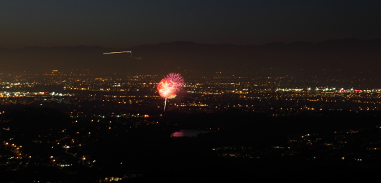
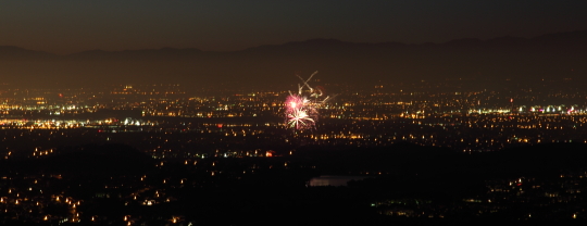
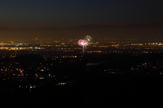
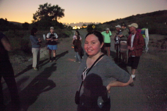
Luckily we broke away from that extremely exciting task to do something that was actually fun. Jamie booked us for an evening hike at Bommer Canyon which is in the South Preserve of the Irvine Ranch though the Irvine Ranch Wildlands website. The hike started at 7:30 PM and went on a 3 mile loop up near the 73 Toll Road and paused at the top of the ridge for a spectacular view of at least eight different fireworks shows all over Orange County. I took the camera along and attempted some shots of the shows below. Only after the hike did I realize I truly needed a zoom lens but I think the shots I captured were pretty spectacular nonetheless. Besides the long exposure night shots of the fireworks I also bumped the ISO up to 25,600 and took some shots lit only by moonlight. This is extremely difficult since you have to manual focus and it’s quite impossible to do anything except estimate distance since it’s dark out. Through trial and error I was able to get these shots somewhat in focus.
The hike was fun and just difficult enough to be challenging. Jamie and I look forward to doing more hikes like this in the future.
You can view the details of our hike here as well as our pictures below:
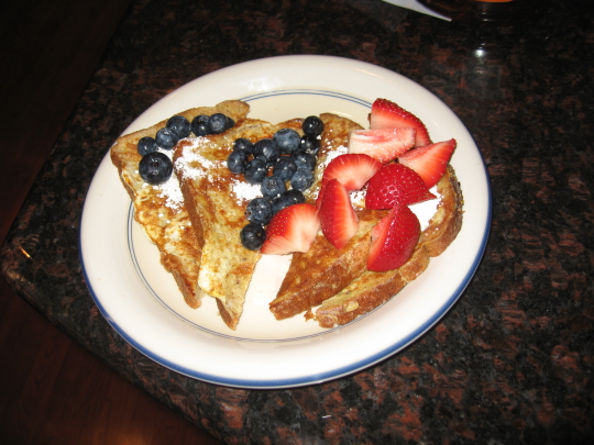
Red, White and Blue French Toast
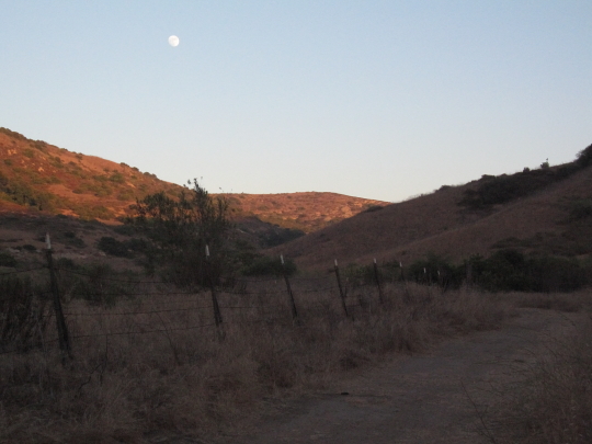
Bommer Canyon trail taken with the SD550
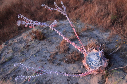
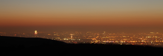
Orange County
Moonlit shot taken at ISO 25,600.


